Model Formulation
The purpose of this page is to provide an overview of the RFS, including its inputs and outputs. If you're primarily interested in using the data, feel free to skip this page and move to the next section.
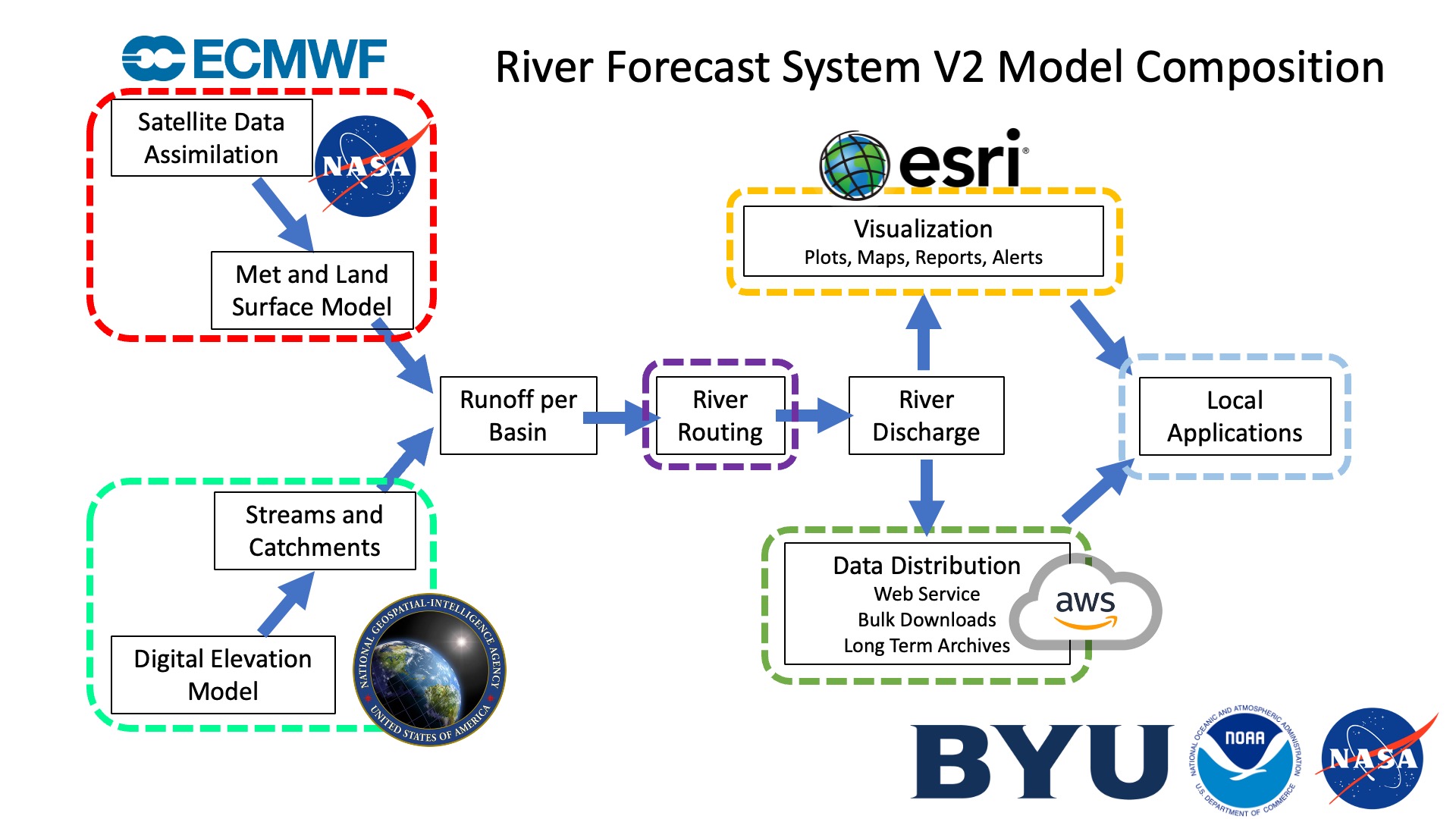
The following graphic provides an overview of the formation of the RFS.
Inputs
The River Forecast System (RFS) depends on three key inputs, as illustrated in the graphic:
-
Hydrography from TDX-Hydro
The river network used by RFS is based on hydrography derived from TDX-Hydro digital elevation data. To prepare this for RFS, the stream network undergoes several modifications and post-processing steps, which are documented in the TDX-Hydro Post-Processing repository. -
Retrospective Land-surface models (ERA5)
Historical runoff data is provided by ERA5, a global reanalysis product from the European Centre for Medium-Range Weather Forecasts (ECMWF). -
Forecast Land-surface models (IFS)
Future runoff predictions are generated using the Integrated Forecasting System (IFS) from ECMWF.
The runoff data from both ERA5 and IFS is converted into streamflow volumes using tools from the basininflow repository.
The following table summarizes the core input datasets used by RFS:
| Name | DOI | Type | Producer | License |
|---|---|---|---|---|
| ERA5 | DOI | Reanalysis Land Surface Model | ECMWF | Copernicus License - Free for commercial and non-commercial use with attribution |
| TDX-Hydro | Link | River and Catchment Hydrography | NGA | TDX-Hydro License - Publicly available, provided "as is" without warranty |
| Integrated Forecast System 48R1 | Link | Forecast Land Surface Model | ECMWF | Requires Paid License |